Brief Introduction
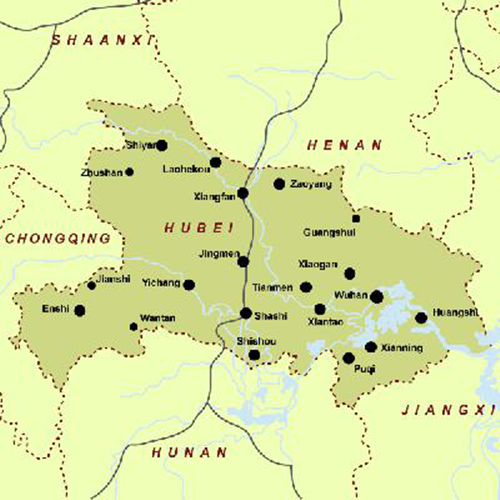
Hubei Province is located at the central part of the People's Republic of China, with short title of 'e'. It is rich in agriculture, forestry and hydropower resources. Agriculture and fishery are well developed in Hubei, with such main products like paddy rice, wheat, ramie, cotton, silk, tea, orange, fish, and vegetable oil, the outputs of which are among the top of the country. Its main industries include iron and steel, machinery, power and automobile. Its capital city is Wuhan.
Location
Hubei Province lies in the middle reach of the Yangtze River with an area of 186,000 square kilometers. Situated 108'21"-116'07" east longitude and 29'05"-33'20" north latitude, it got its name from being in the north of the Dongting Lake. The terrain of Hubei Province is high in the west and low in the east and wide open to the south, the Jianghan Plain.
The province is surrounded on three sides (east, west and north) by mountains. Its low and flat middle part is a piece of incomplete basin slightly open towards south. Of the gross area, there are 56% mountains, 24% hills and 20% lowland lake area.
As to mountains, they are divided into four parts in the province. Northwestern mountains are area extending to the east by Qinling and east section of Daba Mountain. Area extending to the east by Qinling is called Wudang mountain chain, going from northwest to southeast, with lots of mountains. Altitude of ridge of mountains is generally above 1000m, and the highest is Tianzhu Peak of Wudang Mountain with altitude of 1621m. East section of Daba Mountain consists of Shennongjia, Jingshan Mountain and Wushan Mountain, with thick forests and deep river valleys. Peak of Shennongjia is Shennongding with altitude of 3105m, always known as “The First Peak in Central China”.

Climate
Situated in South-central China, Hubei Province features a subtropical monsoon climate. The average temperature for a year is about 15° C (59° F). The Province has distinct four seasons with burning hot summer (June, July and August) and chilly winter (December, January and February). The hottest month, July, averaging 27-30°C and the coldest month, January, 1-5°C.
Wuhan, the capital city in Hubei Province, is known as one of the ‘four stoves’ in China because the torrid climate in summer (there are more than 20 days with the temperature above 35° C or 95° F. The mountainous districts of western Hubei, in particular Shennongjia, with their cooler summers, attract numerous visitors from Wuhan and other lowland cities.
The annual rainfall in Hubei Province is between 800-1600mm on average. Summer is the wettest month in Hubei with 300-700mm in average. Hubei’s driest season is Winter, with average rainfall at 30-190mm. The period from mid-June to mid-July is called the plum rain season in Hubei as the rainfall in this time reaches the peek in the year.
Hydropower
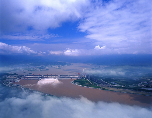
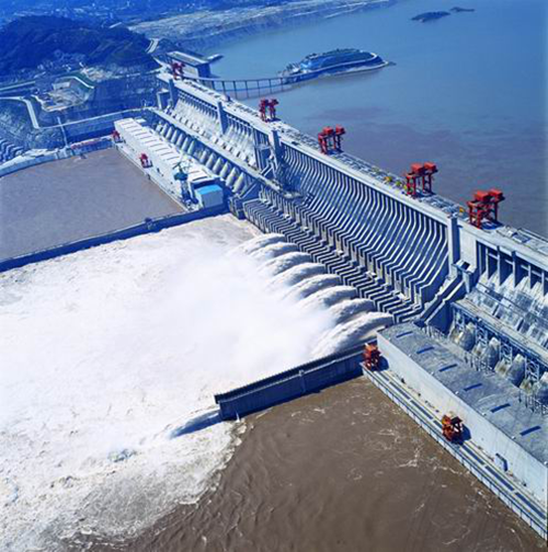
Hubei is the hydropower base of China. There are over 1190 rivers with a total length of 35,000km. Installed capacity of hydroenergy developable is 33, 570, 000 kilowatt, ranking the fourth throughout the country. Currently, the Three Gorges Hyhdropower Plant in Yichang city of Hubei is the largest hydropower plant in the world with the total installed capacity of 22,500 MW and annual power generation of around 100 TWH. It plays an important role in flood control, electricity generation, shipping and tourism. A number of large hydropower plants are also located in Hubei, namely Gezhouba, Geheyan and Danjiangkou.
With the transmission of Three Gorges’ electric power and the completion of China’s first UHV project, Hubei grid has become a modern grid covering the urban and rural areas of the whole province with no more than 110 KV grid.
It has linked up with a 1000KV high voltage grid with a backbone of 500KV grid and a mainstay of 220KV grid. In 2010, the accumulative amount of electricity generation in Hubei province amounted to 202.9 TWH, among which hydropower reached 125 TWH.

The Three Gorges Project

Gezhouba Hyhdropower Plant
Source: hubei.gov.cn
For details: http://en.hubei.gov.cn/